
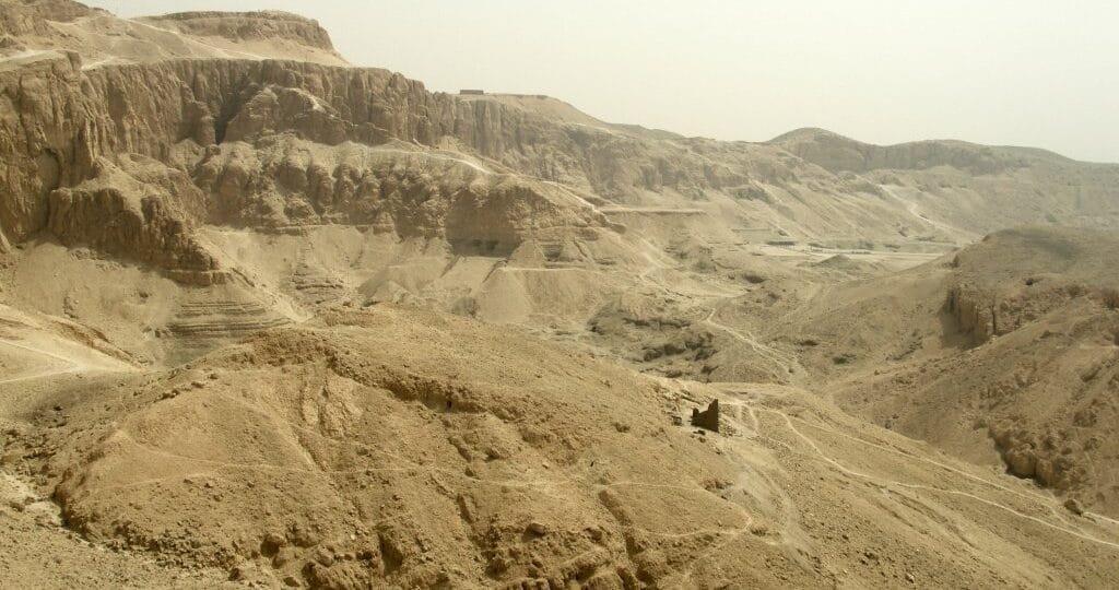
Theban Mountains Egypt: The Sacred Peak Watching Over Luxor’s West Bank
Look past the tour buses at the Valley of the Kings. One shape repeats in almost every photo behind them — a pyramid-shaped ridge standing guard over the whole valley. That ridge is the Theban Mountains, and ancient Egypt trusted a cobra goddess to protect the silence up there.
The Pyramid-Shaped Peak That Guards Luxor’s West Bank
The Theban Mountains rise on Luxor’s West Bank, directly across the Nile from Karnak and Luxor Temple. They form a long limestone ridge, separating the green Nile Valley from the empty Western Desert behind it.
- Ancient Egyptian name: Ta Dehent, meaning “the peak”
- Highest point: El-Qurn, roughly 450 meters above the valley floor
- Modern name: Arabic for “the horn,” describing its sharp summit
One peak dominates almost every West Bank photograph. Its near-perfect pyramid shape narrows to a single point above the desert. Many Egyptologists believe that exact shape is why the Valley of the Kings sits at its foot — a natural pyramid, already built by the mountain itself.
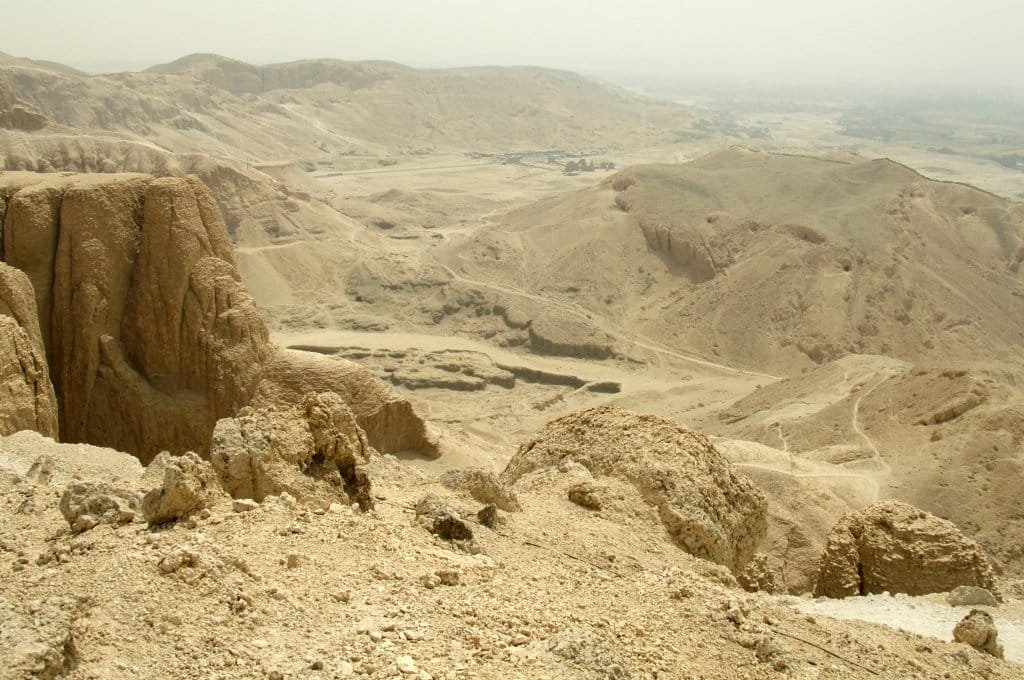
Why Ancient Egyptians Believed a Goddess Lived Inside the Mountain
One goddess claimed this peak as her own: Meretseger, “she who loves silence.” Workers at the royal tombs called her the Peak of the West.
She took the form of a cobra, or a woman with a cobra’s head. Her territory covered the entire necropolis below — every tomb, every workshop, every quiet path between them.
Meretseger punished carelessly and forgave completely. Ancient texts describe her striking tomb robbers and negligent workers blind with venom.
One inscription, the Stela of Neferabu, tells a different side of the story: a craftsman struck blind for a mistake, then healed after he prayed for her mercy. Punishment and forgiveness, carved into the same rock she watched over.
The Daily Walk That Connected a Village to a Valley
Every workday, the artisans of Deir el-Medina crossed these mountains on foot. A steep trail linked their village directly to the Valley of the Kings, cutting hours off the longer route around the cliffs.
Guards once watched that path from small stone huts. Several still stand near the ridgeline today.
Walking the West Bank now, it’s easy to forget these mountains were once a commute. Curious about the village at the trail’s start? Our Deir el-Medina excursion guide covers the homes, tombs, and workshops the path connected to the valley beyond.
The Government Ban Most Travelers Never Hear About
You can no longer climb to the true summit of El-Qurn. Egyptian authorities restrict access to the peak, and the area is monitored to protect both the site and its surveillance equipment.
Two trails once carried hikers to the top: one from the Valley of the Kings, one from Deir el-Medina. Sections of both remain walkable, but the final approach to the summit itself is now off-limits.
Most first-time visitors never hear this. Guidebooks rarely mention it. A local guide will know the current rules before you set out — always confirm access on the day, since restrictions around the necropolis can shift with little notice.
Theban Mountains at a Glance
| Ancient name | Ta Dehent, “the peak” |
| Highest point | El-Qurn, about 450 meters |
| Guardian deity | Meretseger, cobra goddess of silence |
| Sacred association | Believed to mark an entrance to the underworld |
| Neighboring sites | Valley of the Kings, Valley of the Queens, Deir el-Medina, Hatshepsut’s temple |
| Summit access | Closed to public climbing |
| Best viewpoints | Hot air balloon, Deir el-Bahari terraces, West Bank bike routes |
How Most Travelers Actually See the Mountains Today
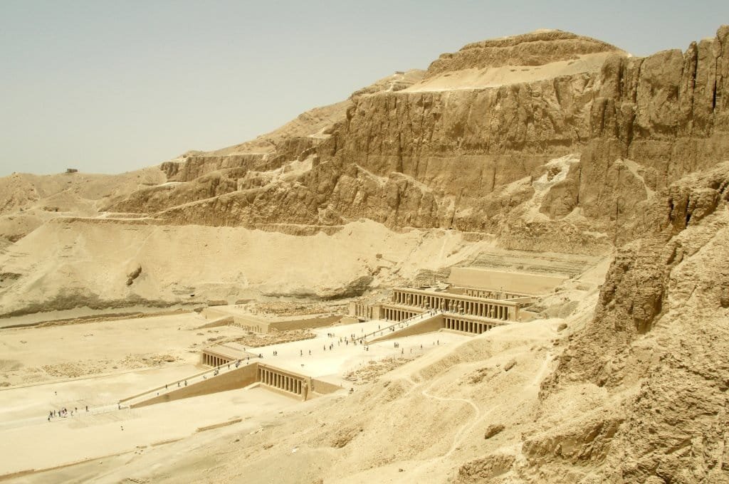
With the summit closed, most visitors experience these mountains from below, or from the air above them.
- Sunrise hot air balloon flights drift directly over the ridge
- Bike routes trace quiet roads beneath the cliffs
- The terraces at Hatshepsut’s temple frame the mountain face perfectly
Ready to see the mountain from above instead of below? Our Luxor Hot Air Balloon flight drifts directly over the ridge at sunrise, with the Valley of the Kings unfolding underneath.
The Necropolis Living in the Mountain’s Shadow
Nearly every major West Bank site sits directly beneath these cliffs, sheltered by the same ridge that once held Meretseger’s temple.
- The Valley of the Kings, cut into the mountain’s eastern face
- The Valley of the Queens, tucked into a side valley nearby
- The Temple of Hatshepsut, built directly against the cliff wall
- The Habu Temple and the Tombs of the Nobles, spread across the lower slopes
First time planning a Luxor visit? Our complete guide to Luxor’s East and West Banks lays out how all of these sites connect in one trip.
Explore all of it in a single guided day. Our West Bank day trip pairs Hatshepsut’s temple with the Valley of the Kings, right beneath these same mountains.
Planning beyond the West Bank? Many travelers pair Luxor with Cairo’s pyramids, sail south toward Aswan’s temples, or unwind afterward on Hurghada’s Red Sea coast — a natural extension once the mountains and their necropolis are behind you.
A Local Guide’s Take on the Mountain Everyone Photographs, Few Understand
“Most visitors never look up,” says Mahmoud, a Nile Travel Machine guide based in Luxor. “They’re focused on the tomb entrance in front of them.
I always stop and point at the peak first. Once you know a goddess supposedly lived up there, the whole valley feels different.”
His practical tip: visit Deir el-Bahari in the early morning, before the heat sets in. That’s when the light hits the cliff face directly, and the mountain’s pyramid shape stands out sharpest against the sky.
Frequently Asked Questions About the Theban Mountains
Can you still climb to the top of the Theban Mountains?
No, not to the true summit. Egyptian authorities restrict access to the peak of El-Qurn, and the area is monitored. Lower sections of the old trails remain walkable with a guide.
Why do the Theban Mountains look like a pyramid?
The highest peak, El-Qurn, narrows to a near-perfect point above the valley. Many Egyptologists believe this natural shape influenced the pharaohs’ choice of the Valley of the Kings directly beneath it.
Which goddess protected the Theban Mountains in ancient Egypt?
Meretseger, whose name means “she who loves silence.” Workers pictured her as a cobra, guarding every tomb and workshop across the necropolis below her peak.
What is the ancient Egyptian name for the Theban Mountains?
Ta Dehent, meaning “the peak.” Ancient workers also called the summit the Peak of the West, tying it directly to Meretseger’s role as its guardian.
Conclusion
The Theban Mountains don’t need an open summit trail to leave an impression. Every tomb, temple, and painted ceiling on Luxor’s West Bank sits in their shadow, watched over — ancient Egyptians believed — by a goddess who loved silence. Ready to stand where she once stood watch? Book your West Bank day trip with Nile Travel Machine.
About the author: This guide was reviewed by the Nile Travel Machine Luxor team, drawing on years of on-the-ground experience guiding travelers across the West Bank necropolis.